Orientation
ABOUT THIS MODULE
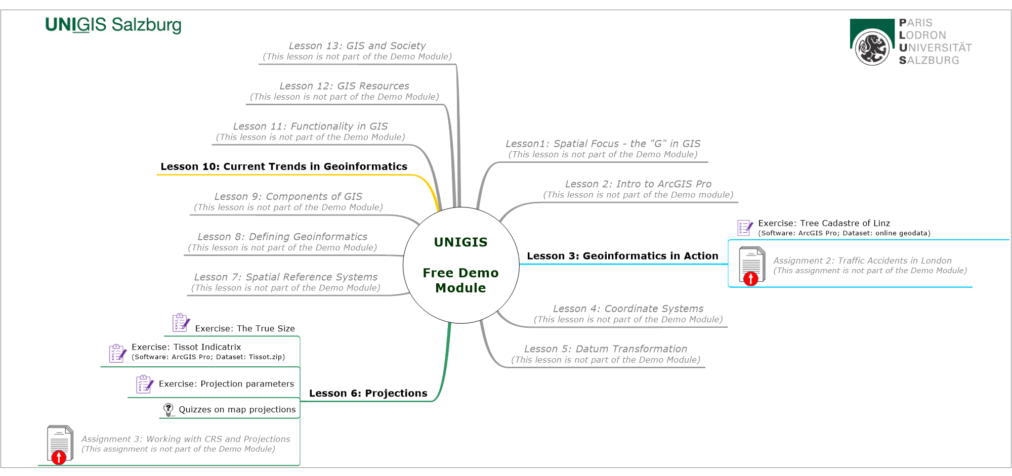
This Demo is structured like any UNIGIS module. It is a subset of the first module of the UNIGIS program "Introduction to Geoinformatics". At its core these are the module materials presented as an interactive webbook (in this free module only 3 select lessons are accessible) and a discussion forum to comment, ask questions and discuss with the lecturer and the peer students. Further, you will find sections for software, assignment submission and the possibility for anonymous feedback.
LEARNING OUTCOMES
This Demo module aims to:
- provide an insight into how UNIGIS distance learning works in practice,
- highlight some application domains and trends in Geographical Information Science and Systems.
Upon completion of this module you should be able to:
- assess, whether this format of distance learning meets your needs,
- have a deeper understanding of the subject of study, its methodological foundations and domains for application.
QUICK VIEW
The Demo module consists of 3 (out of 13) publicly accessible lessons from the first module "Introduction to Geoinformatics". It will take you about two evenings to work through these lessons.
UNIGIS students have 8 weeks to complete one module, which results in an average workload of 12-15 hrs per week. However, this is a rough estimation as the workload might differ, depending on the lesson content, your experience and prior knowledge to the topic.
IMPRINT, COPYRIGHT AND DISCLAIMER
This module is published for the purposes of the UNIGIS Distance Learning Program of the Department of Geoinformatics - ZGIS at the University of Salzburg. Prof. Dr. Gudrun Wallentin is responsible for the content of this module.
Contents of this module - if not stated differently - are copyright © UNIGIS 2026. UNIGIS participants are only granted the right to personally use these materials for studying purposes within the framework of the current UNIGIS program. We reserve the right to pass on, store, duplicate and take over parts of the material. Any other use of materials beyond UNIGIS studies requires the written permission of the copyright holder.
The authors of this module explicitly state that all brands and product names are trademarks or registered trademarks of their respective owners and are used for illustrative and explanatory purposes only. Missing reference to registered trademarks etc. in the text does not imply free usage of product and brand names!
UNIGIS and the UNIGIS logo are registered trademarks of the Department of Geoinformatics – Z_GIS, University of Salzburg (Austria) and the UNIGIS International Association.
Please note while every precaution has been taken in the preparation of this module, the authors assume no responsibility for errors or omissions. Neither is any liability assumed for damages resulting from the use of the information contained herein.